Walk 11 – Ramla Bay to Ghadira Beach
Not one, not two but three friends joined me on this walk! Sarah is back for her third walk with me and now we are joined by newbies Lynn and Michaela. The numbers are increasing so the word has clearly spread around Malta.
This walk in the book officially starts from Cirkewwa and goes to the end of Ghadira beach covering the whole of the Marfa peninsula – the Northern peak of Malta. However, I decided we should start at Ramla bay just because it was easier to park away from the ferry terminal. So officially I have missed out the bit of land between Paradise bay and Ramla bay but never mind.
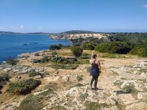
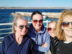 Lynn, Sarah, Kayla and me at the start of the walk, Ramla bay
We got out the car in Ramla Bay and it was surprisingly windy despite it feeling quite warm when I’d left home. That’s the thing with living on a small island – often one side is windy and another is fine.
From here at Ramla bay, you can get a small boat over to the island of Comino which I did recently. Comino is a very small island between Malta and Gozo which is more or less uninhabited and without traffic. Much of the island is a protected area and is relatively empty apart from the main attraction – the Blue Lagoon. This very beautiful lagoon, which is indeed very blue, attracts thousands of tourists which spoils the experience in the summer. So if you go, go out of season I would say.
 Leaving Ramla bay with Comino in the distance
Off we went with beautiful views of Comino and beyond that Gozo. For this walk, I recklessly abandoned the book as the route looked quite simple and it looked like there weren’t many detours away from the coast.
 Just beyond Ramla bay, Sarah, Kayla and Lynn
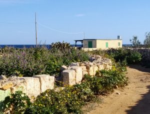
As we looked back east to our starting point we could see the large hotel resorts at Cirkewwa but once we had passed the big Ramla bay resort it was like we were leaving civilization behind. Replacing the big hotels were small white huts – which mostly were locked up for the season. Presumably, when local owners move up here for the hot summer months the place is very different.
 Walking away from civilization towards Armier bay
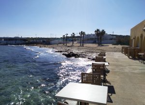 Mambo at Palm beach, Armier bay
We reached Armier bay which I’ve been to a few times before. If it’s not too busy this is a great little beach with a few nice restaurants on the beach. One is Mambo which even looked open although there was no one around at this time. As it was too early for a coffee stop we pressed on to the next smaller beach called Little Armier.
Little Armier is another nice sandy bay with a nice restaurant ‘Rays Lido’ and in the summer it’s also a good alternative to some of the busier sandy beaches on the west coast.
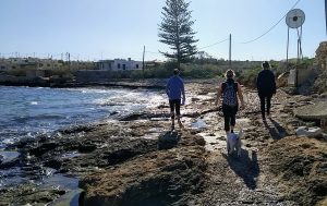
 White Tower Bay
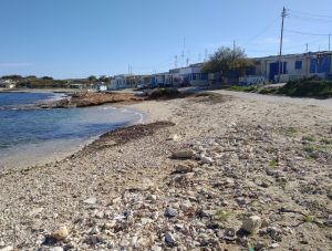
A nice and easy flat walk from here to the next bay which I’d never been to before, White Tower Bay. A rockier beach with more of the little white houses with blue doors which actually looked very Greek. Really very pretty up here and I imagine more of a locals area with fewer tourists venturing this far. I’ll definitely be back to this beach though as it’s quite different to anywhere else in Malta.
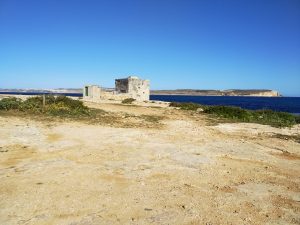
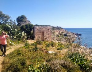
 The White Tower
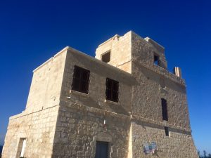
From here we headed inland and uphill (not a very big hill) to the White Tower (Torri l-Abjad). A strategically placed defence building from the time of the Knights. There are defence towers and batteries all around the island but here on the Marfa promontory, the coastal defences are some of the better-preserved ones on the island. Now it just makes a great viewing spot.
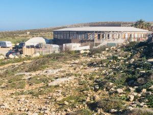 The campsite
We carried on down the far side of the hill towards the next bay and we spied a very strange large circular building. A very odd building, totally unlike anything I have ever seen in Malta. Was it a conference centre or a really cool restaurant? (we got slightly excited about that possibility). We walked up to it only to discover it was attached to a caravan site and so must be their clubhouse or indoor area. We poked our heads into the caravan site but couldn’t see anyone around. Taco had a good sniff at the astroturf though.
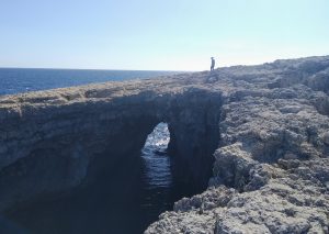 Dragonara or Coral Lagoon
From here that wasn’t really a path but we started to walk up the rock to the northernmost point of Malta. And then quite unknowingly we came across a huge hole in the rock with a lagoon below. After consulting the book I found out this was the collapsed cave known as the Dragonara or the Coral Lagoon. It was actually very impressive and well worth a visit although quite scary to look down into and I had to take hold of Taco because I was petrified she would fall in. Mark later told me he’s kayaked into it before which must have been pretty incredible.
As we walked away from it there was a group of school children walking up as if on a trip. Bit of a scary place to take them I thought but later Myles told me he’s been on a school hike here too (he just failed to tell me at the time).
Standing here we were pretty much at the most northern tip of the island and about as far as you can get from Birzebbuga right down in the far south. Incredible to think how far I’ve walked.
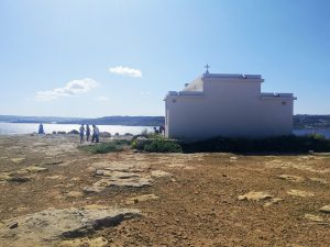 white church from the back
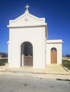 White Church
We then changed direction to head across the rock southwards. It was hard uneven rock here with craters and no obvious walking path so quite hard to walk along. But we had amazing views with Comino was just behind us and clear blue sea down below the cliffs. The terrain changed getting greener with some shrubs, small trees and a shady grove (note – great spot to come and camp!).
Then suddenly we came across a little white chapel and a statue apparently devoted to our Lady of the Immaculate Conception. This was also a bit of a site seeing point as there were a few cars and motorbikes parked around.
 Heading South now to Mellieha Bay
From here we could now really see our route ahead straight down the eastern side of the island towards Mellieha and beyond. Beautiful!
 The terrain became quite lush with higher cliffs down to the sea
Walking on from here the terrain became even greener with pine trees and shady groves with acacia trees. What a great family picnic spot (well apart from the rather sharp drop down to the sea). We were quite high up and could look down at beautiful rocky inlets which looked difficult to get to other than by boat.
We stayed up high following a small windy path through the trees but eventually we joined the road (which was pretty empty anyway) and followed this along until we got to a junction with a bigger road.
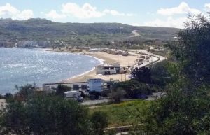 Ghadira Beach
Finally, we were looking down at Ghadira beach in Mellieha Bay. This is the longest sandy beach in Malta which is popular with tourists and locals and in summer it’s hard to see the sand for the hundreds of sunbeds. Out of season, it’s nice though and there are a few nice cafe’s where you can sit right by the water.
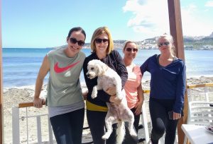 Sarah, me, Taco, Kayla and Lynn in Munchies for breakfast
We continued down on to the sand and Taco had a run and roll in the sand and dipped her paws in the water. Then we all sat down to a much-deserved breakfast at Munchies. What a great walk and so nice doing it with some friends.
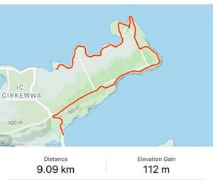
The walk was 9 km and took us about 2 hours 15 mins. All in all one of the easier walks just because there very few inclines and it was quite easy to follow. Well done team!