Gozo coastal walk
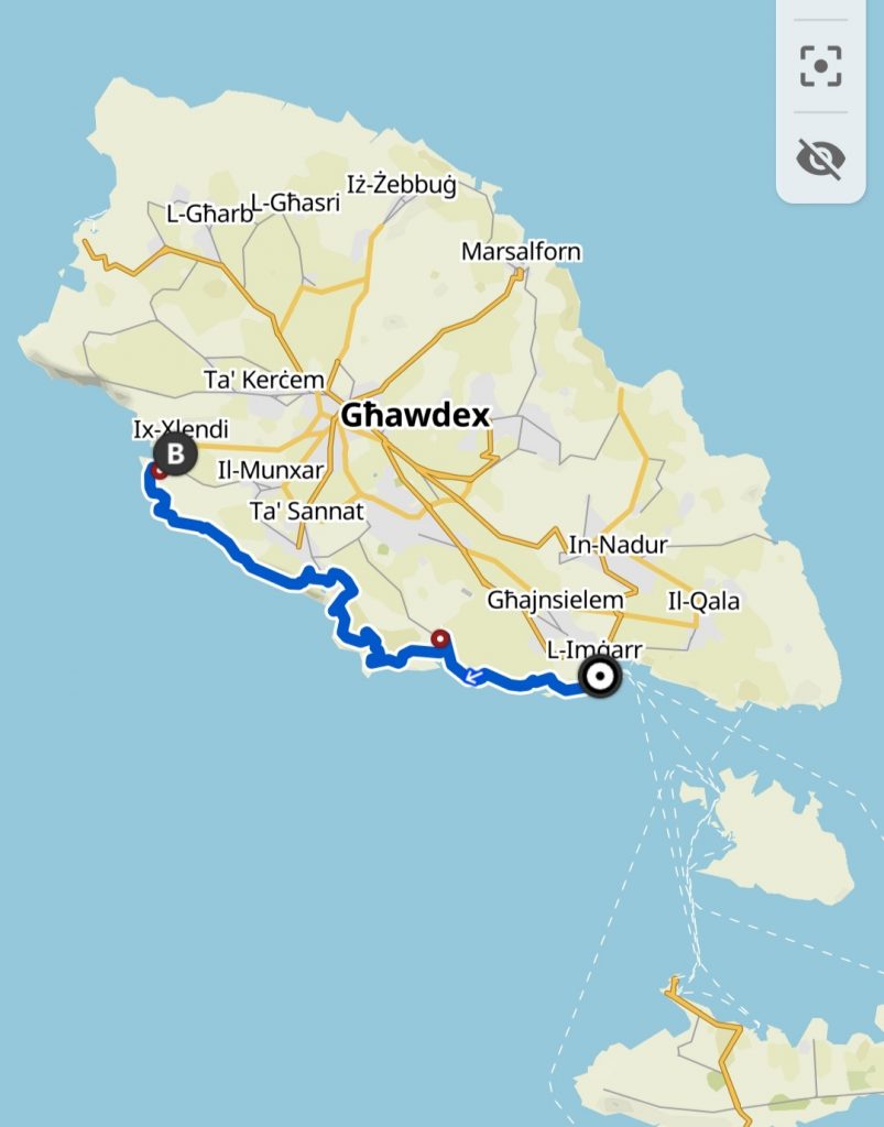
Day 1: Mġarr Harbour to Xlendi Bay
Gozo – the little sister island to Malta has a circumference of just 55km (compared to Malta’s huge 155km coast). It took me 14 walks to get around Malta so hiking around Gozo should be a breeze!
The walk around Gozo can be broken down into four walks starting from Mgarr Harbour. Much as I would have loved to do all four walks in 4 days I only had time for the first two on this trip.
Places to stay are plentiful in Gozo and easily affordable so we planned to stay overnight in the village where the first walk would end and the second walk would start.
“If you think adventure is dangerous, try routine, it’s lethal.”
Paulo coelho
Cliffs, peninsulas, beaches, inlets, fields, flowers and lots of yellow rock. The coast route around Gozo has plenty of similarities with the coastal route around Malta but it’s more remote, a bit wilder and definitely less busy. It was already feeling like more of an adventure this time.
Start of the walk – Mġarr Harbour
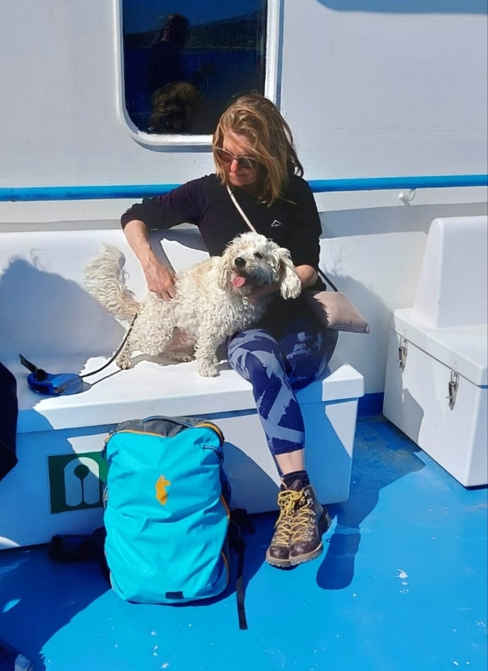
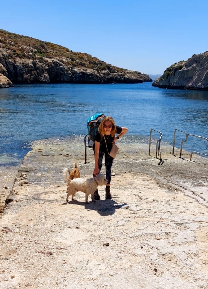
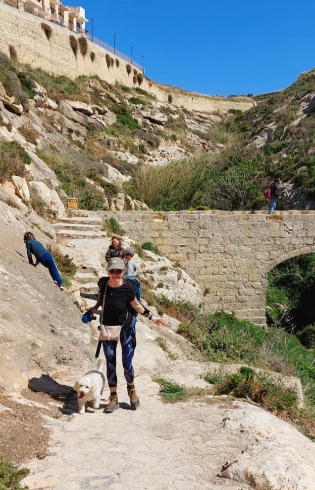
A short ferry ride from Malta (20 minutes) and we were in Mġarr Harbour. We left the car in Malta so we were carrying small backpacks with everything we needed. The walking party included me, my friend Paula and Taco (of course).
The weather was perfect. Sunny, about 18 degrees with a light breeze.
The route begins at the end of a small car park to the side of the ferry terminal. It’s pretty easy to find and there were actually a few other walkers.
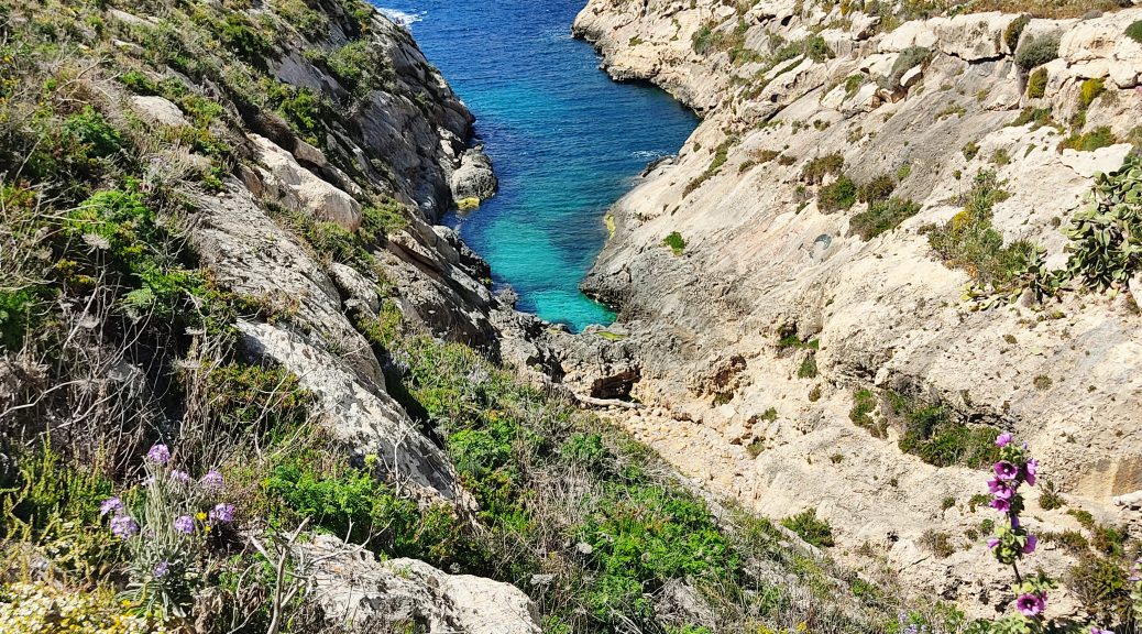
Not the kindest way to start with an upward path but once at the top we were instantly rewarded with views of some idyllic beaches below. Other than a few groups of divers these small beaches were deserted. And all so easily accessible on foot from the ferry! We’d only just started but it was hard to crack on with the walk because we just want to stop and admire the views constantly.
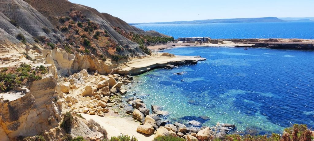
Mġarr xi-Xini
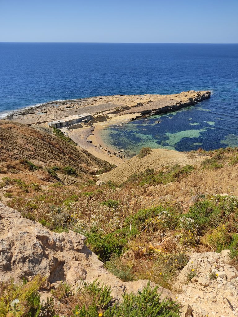
After ooohing and arhhhing for about an hour, we finally arrived at the stunning Mgarr ix-Xini (pronounced She-knee). This bay lies in a gorge at the bottom of a valley and even on a windy day the water is sheltered so was very inviting for a swim (but it was still a bit cold so we didn’t get in).
We set down our rucksacks and enjoyed the view whilst tucking into our sandwiches. There are a couple of nice places to eat here offering seafood from a few well-placed plastic tables and chairs on the beach. If you want a smarter dining experience then the fabulous Ta’ Cenc Il-Kantra Lido, Bar & Restaurant is a bit further round the peninsula perched at the top of a cliff with views and food to die for.
Accessing Mġarr xi-Xini by car is possible but isn’t for the faint-hearted. It’s a really narrow road down from the cliffs at the top which is just about okay until you meet a car trying to come up the hill. If you do make it to the bottom in one piece you have the added challenge of finding a spot to park in. Not an easy task with a ‘car park’ the size of a napkin. Now that I know how easy it is to walk from Mġarr harbour I’ll be leaving the car at home when I come again.
Sannat
Another climb (a theme of the walk) and then the path headed inland for a bit into the small village Ta’ Sannat. We walked past an interesting statue that we couldn’t make any sense of. But an information board nearby told us all about it.
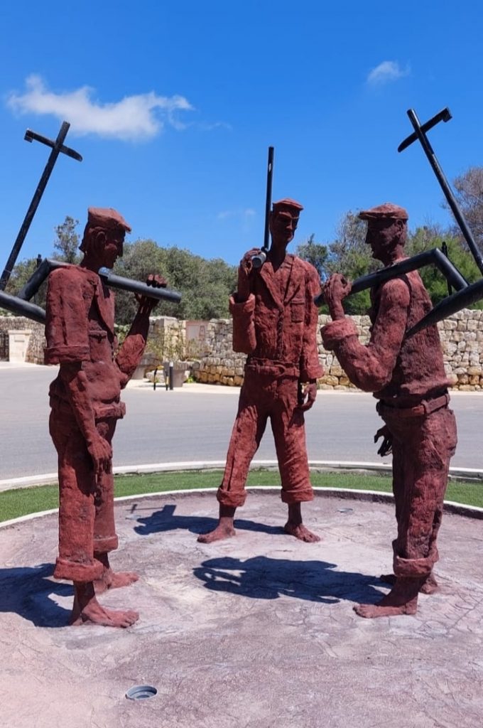
Bdiewa
This work depicts farmers talking after a day’s work. The three figures represent three generations of farmers- the young, the middle-aged and the old. The old farmer is positioned facing the young figure signifying that he is passing on his experience to the lad.
The farmers are holding the traditional ‘mohriet’ (plough) which was used to work the land for planting. The plough, which was pulled by a mule or donkey, was made of wood while the blade was cast in iron and fitted at the tip. The handle was shaped like a cross. The farmer held the handle with his left hand and the rail with his right.
The handle symbolises the cross and therefore the suffering that the local farmer had to endure – the manual work, long hours and the weather (hot summers and cold, windy winters). This monument, which was inspired by a lino print created by the artist’s father (Antoine Camilleri,1922 2005) is a tribute to honour and remember our forefathers.
Antoine Paul Camilleri 2016
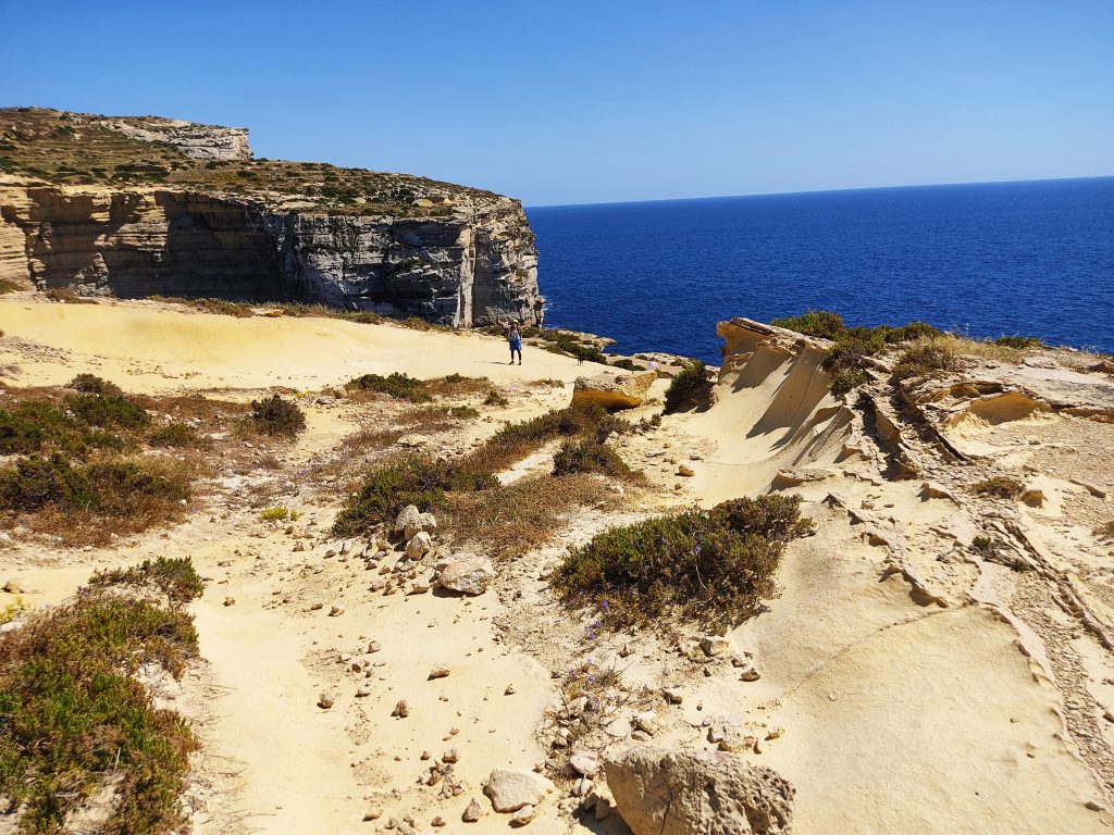
Ta’ Ċenċ Cliffs
Heading back towards the coast we passed through fields of flowers. April really is the perfect time to be walking in Gozo.
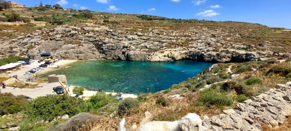
We reached the coast arriving at the beautiful Ta’ Ċenċ Cliffs. These limestone cliffs sit 120 meters above sea level (which is comparable to the Dingli Cliffs in Malta) and drop down sharply into the sea. It’s an important bird area and the cliffs were once the breeding ground of the now extinct Maltese peregrine falcon. Looking inland we had views right across Gozo of Victoria, Xewkija and Xagħra.

Paula and Taco at the Ta’ Ċenċ Cliffs
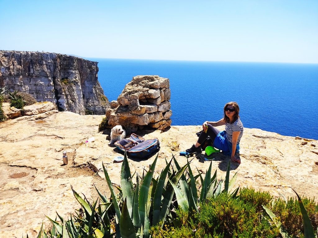
We nervously stopped for a drink and a snack by the edge of the cliff. Even Taco looked nervous (and hot).
Refreshed we continued on passing the luxurious 5-star Ta’Cenc hotel & spa. Well out of our budget for this trip but definitely on my list to stay at one day.
Hugging the coast we continued on. Taco was getting hot and tired as we’d been walking for over 3 hours and the rucksacks seemed to be getting heavier and heavier.
Xlendi Bay
We were now on a sealed path and we could just about see Xlendi ahead of us.
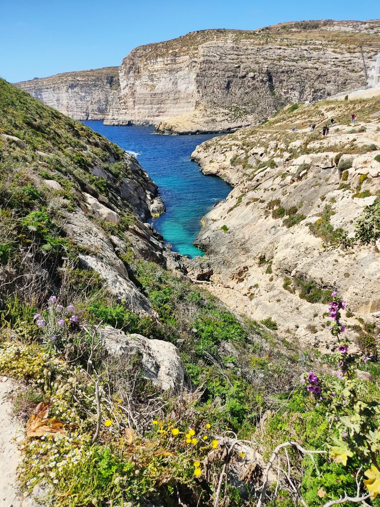
The path that leads into Xlendi is stunning. Perfect blue-green waters and at this time of year beautiful flowers and greenery. We passed the Xlendi Tower, built in 1650 by the Grandmaster Juan de Lascaris-Castellar and Taco suddenly left my side (which she never does) and raced down to the water. She’d clearly been up on the cliffs too long and needed to dip her paws and belly in the water.
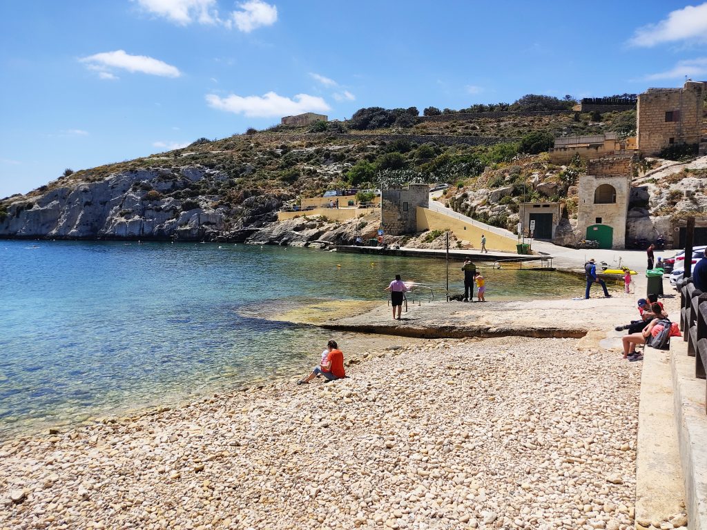
Ix-Xlendi Bay is a popular destination in Gozo for both tourists and locals. It’s a village set at the bottom of a valley with a good selection of restaurants and hotels. It’s also popular with divers. If you’re travelling by car, you’re rewarded with a dramatic drive down to this village which is nestled between cliffs on either side.
However, Xlendi Bay is talked about by the Maltese with sadness and anger and many refuse to visit now. The once quaint, scenic village is now dominated by high rise unfinished apartments and there is constant noise from cranes and construction. The recent destruction of one of the few remaining low rise restaurants on the front was met with fury, disbelief and sadness.
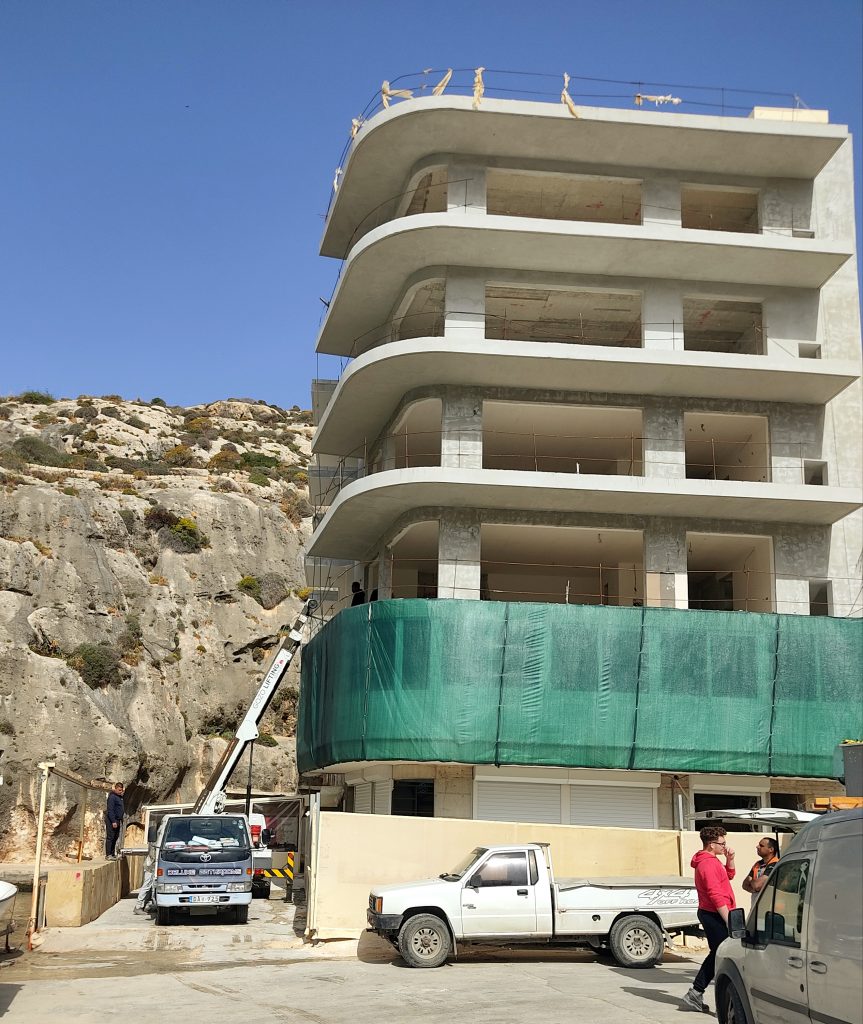
Despite all of this Xlendi still makes a convenient spot to explore this area of Gozo and there is still a buzz about the village in the many restaurants at night. Although the beach is pebbly there are plenty of places to swim at the side and an excellent diving board (a popular draw for the kids in summer).
A pleasant stroll along a well maintained paved path led us to our hotel, the ‘pet-friendly’ San Andrea Hotel . Turns out they weren’t just pet-friendly they were very human friendly too and we gratefully collapsed on to our very large double bed ditching our now very heavy backpacks.
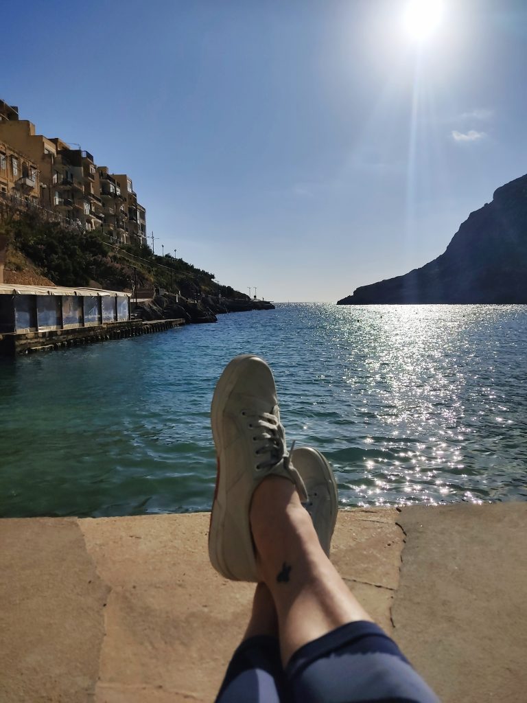
We literally fell outside to the bar at the front of our hotel and put our feet up whilst we enjoyed a well-deserved drink and rest. An excellent 13km walk which took us around 3.5 hours as we stopped quite a bit to take photos and enjoy the view. Time to re-charge before the day two walk tomorrow.